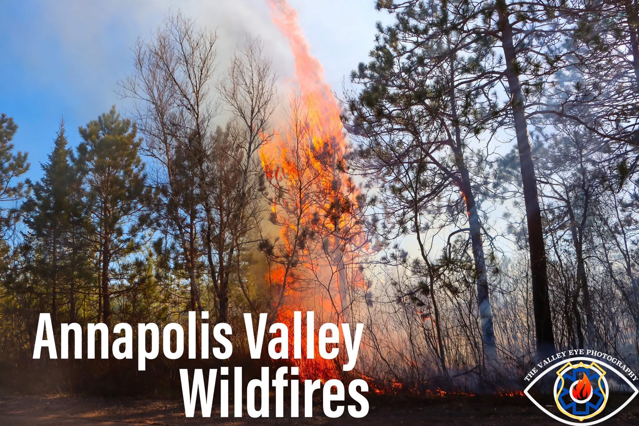
There have been a number of wildfires reported over the last week and a half in the Annapolis Valley.
Full wood travel restrictions & burn restrictions remain in place in Annapolis County.
While woods restrictions and burn restriction have been lifted for the remainder of the province. The Nova Scotia burn restrictions have been set to no burning permitted over the last several days since the Lake George Wildfire.
Below is a list of fires and status’s along with their APPROXIMATE area burned.
Terms:
🔴 Out of Control – Growing or expected to grow until efforts halt spread.
🟡 Being Held – Further spread has been halted, perimeter around the fire has been made and is not expected to grow. Smoke can still be visible and can be reclassified as out of control.
🟢 Under Control – The fire has received enough fire suppression, to ensure there is no risk the fire will spread beyond its perimeter.
🔵 Extinguished – The fire has been declared out, all hotspots have been extinguished and will not reignite.
Fires over the last week and a half + Lake George and Long Lake Wildfires that remain active:
🔥Lake George Wildfire, Kings County
🔴 Out of Control
🏞️ Estimated Size 288 Hectares
🔥 Clementsport Wildfire, Annapolis County
🔵 (Believed to be extinguished)
🏞️ Estimated Size 0.1 Hectares
Active ✅
🔥 West Dalhousie / Long Lake, Annapolis County
🟢 Under Control
🏞️ Estimated Size 8,468 Hectares
🔥Cambridge Wildfire, near Michelin, Kings County
🔵 (Believed to be extinguished)
🏞️ Estimated Size 0.01 Hectares
🔥 Baxter’s Harbour Wildfire, Kings County
🔵 Extinguished
🏞️ Estimated Size 0.1 Hectares
🔥 Bligh Road Wildfire, Woodville, Kings County
🔵 Fire Status – Extinguished
🏞️ Estimated Size 0.1 Hectares
In the last 7 days, there have been 8 wildfires reported across Nova Scotia.
So far this year, 13 wildfires have been reported in Annapolis, 14 in Hants & 21 in Kings Counties. Totally 48 wildfires in all three counties.
To date, there have been 168 wildfires reported across Nova Scotia.
Approximate area burned across Nova Scotia to date is 8,855.92 hectares.
⚠️ Please Note DNR disclaimer on size estimates and classifications per the viewer, status’s of fires have been adjusted based on reliable sources:
“The data in this application is a graphical representation of current year wildfire activity. Because of the dynamic nature of weather and wildfire activity, the data may not reflect the current situation and should not be relied upon as accurate. Wildfire locations are approximations, actual extent of wildfire areas may be different between the provided application and what is happening on the ground.
Wildfire application data is updated when practical and occurrences of individual wildfires updates will vary.”
The Wildfire Nova Scotia Viewer can be located below 👇
https://experience.arcgis.com/experience/0ee935539ce5495d86ce607d11a57a30
Adrian J.res