Skip to content
Tuesday, January 20, 2026
The Valley Eye Photography

The Valley Eye Photography

Providing followers with community based content, breaking stories and local photography in and around Annapolis, Hants & Kings Counties in Nova Scotia

  • Local News
  • Community
  • Photo Library
    • Emergency Services
    • Sunrise and Sunset
    • Waterfalls
    • Nature and Landscape
    • Farming
    • Public Works
  • About
  • Contact
site mode button

Lake George Evacuation area and burn area per DNR

Local News
October 3, 2025November 13, 2025thevalleyeyephotography

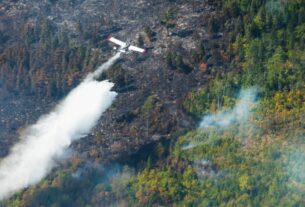
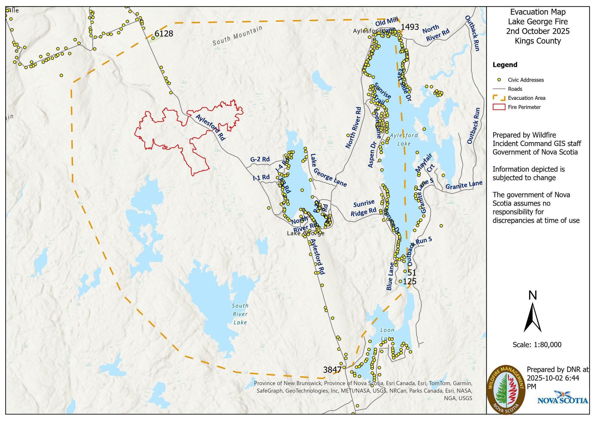
The Lake George Wildfire still estimated at 250 hectares. 

Attached is the fire zone area and the current evacuation area. 

Map via Department of Natural Resources.

Tagged DNRKingsLake GeorgeMapWildfire

Post navigation

Woods Fire in Woodville brought under control
Lake George Update via DNR

Related Posts

More precise measure for Lake George Wildfire

September 30, 2025November 12, 2025thevalleyeyephotography

⚠️  EXPANDED MANDATORY EVACUATION – West Dalhousie

August 14, 2025August 21, 2025thevalleyeyephotography

Hazardous conditions and accidents being reported

November 28, 2025December 17, 2025thevalleyeyephotography

LOCAL WEATHER


Important Links

The Valley Eye Photography Facebook

Nova Scotia Emergency Management Office

Nova Scotia Burn Map

Nova Scotia Power Outage Map

Nova Scotia 511

Nova Scotia Highway Cameras

Maritime Weather Facebook


Copyright 2025 All Rights Reserved | Theme: News Portal by Mystery Themes.